
Skokie ZIP Directory Coverage
Official Village maps and planning material identify three principal ZIP codes in Skokie's municipal context. The Village map is a visual boundary source and labels major streets such as Central, Church, Davis, Gross Point, Golf, Niles Center, and Skokie Boulevard. It does not publish a text list of all house-number ranges, so no range should be inferred from the drawing alone.
| ZIP | Village context | Postal treatment | Directory note |
|---|---|---|---|
| 60076 | Included on the official Skokie ZIP map | USPS labels it Skokie | Park District includes all addresses; verify the parcel |
| 60077 | Included on the official Skokie ZIP map | USPS labels it Skokie | Park District includes all addresses; verify the parcel |
| 60203 | Included in Village maps and planning references | USPS uses an Evanston label | Park District includes all addresses; keep postal and municipal fields separate |
| 60053 | Not a principal Village ZIP | Address-specific postal label | Only specified Morton Grove ranges fall within the Park District exception |
The complete Skokie ZIP code directory therefore treats 60076, 60077, and 60203 as the Village's three official references. It records 60053 only when the exact address fits the Park District's listed Central, Linder, Long, or Kirk range. Special-district inclusion does not automatically establish Village jurisdiction.
Do not describe broad north, south, east, or west street ranges unless the cited map shows the exact address. The Village source supplies a boundary picture, not a complete range table. A lookup should retain the map URL and date, then confirm close calls with the parcel viewer. This is especially important near adjoining municipalities, where a familiar community name may reflect mailing practice rather than the agency that governs the parcel.
Why Skokie ZIP 60203 Says Evanston
ZIP 60203 is the key local geography wrinkle. A Village map can place the address in Skokie's municipal context while USPS uses Evanston as the mailing city. At the same time, Skokie Park District policy treats all 60203 addresses as resident territory. Those sources answer different questions, so none should be “corrected” to match another.
For a useful directory record, retain the five-digit code, postal city, municipality shown by the Village or county map, special-district status, Cook township, and parcel identification number when available. That method lets a family historian or property researcher reproduce the search without turning the mailing label into a legal-boundary claim.
The Park District rule is useful but narrow. It says all addresses in 60076 and 60077, all 60203 addresses, and only specified ranges in Morton Grove 60053 fall within its resident boundary. It does not convert those postal zones into the Village border. When a program, tax, or election question depends on jurisdiction, use the map and policy of the agency that will make the decision.
Verify a Skokie ZIP With USPS
The USPS location search checks an address or ZIP and can return facilities, location types, and distance sorting. The Skokie Post Office result is 4950 Madison Street, Skokie, IL 60077-2570, phone 847-676-2232. The Skokie Postal Store is 9318 Skokie Boulevard, Skokie, IL 60077-1300, with the same published phone.
The postal search screen below is useful for confirming how an address should be mailed and where service is offered.
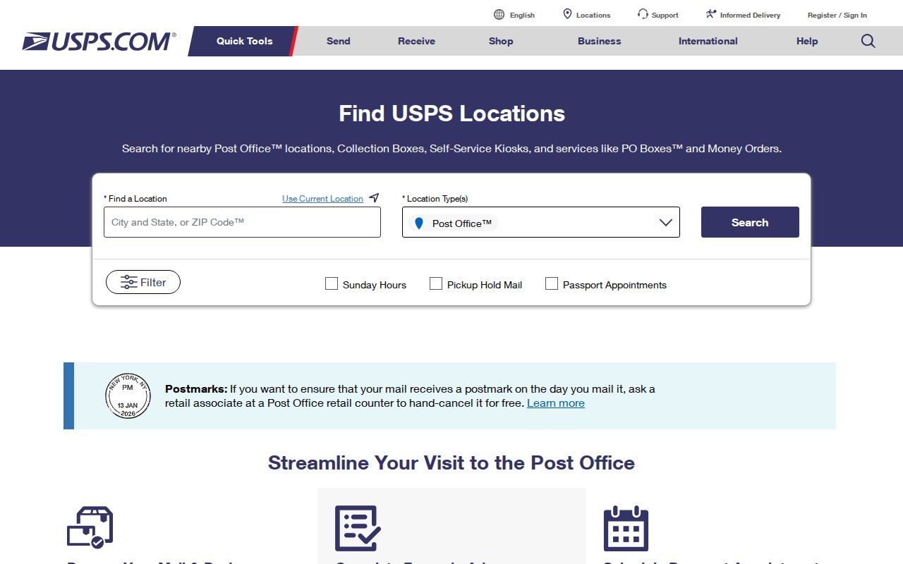
Use the result as a postal fact. For city limits, turn to the Village GIS or ZIP map. For ownership and tax work, move from the address to CookViewer and its PIN.
Find Skokie Residents by ZIP
A ZIP code can limit the first pass, but none of the official systems publishes a free, unrestricted ZIP-wide resident roster. The Illinois voter lookup confirms one person's registration status after the user supplies identity and address details. County property tools begin from a parcel or street address. Use this Skokie ZIP code directory as a routing layer, then search the right custodian.
- Confirm the address and postal label with USPS, keeping the five-digit code exactly as returned.
- Check the Village ZIP or jurisdiction map when Skokie status matters, especially for 60203 and the 60053 exception.
- Use CookViewer with the address to find the parcel and 14-digit PIN, then follow its links to the Assessor or Tax Portal.
- For your own voter status, enter the required name, date of birth, and ZIP before selecting the ZIP-dependent street name.
- Once the search reaches a named road, use the Skokie street directory for address-level records and deed research.
Keep a note of which portal supplied each field. A postal city, situs address, tax mailing address, and legal description can all differ without any record being wrong.
Skokie ZIP Search Fields
The state voter form is the clearest ZIP-dependent official search documented in the research. It does not accept a ZIP alone. Required identity fields come first, and the street-name list appears only after the five-digit ZIP has been validated. This design confirms one registration rather than exposing a public roll.
| Field | Format | Required | How it behaves |
|---|---|---|---|
| First and last name | Alphabetic, with limited punctuation in surname | Yes | Identifies the voter record being checked |
| Birth date | MM-DD-YYYY | Yes | Used for identity matching |
| ZIP | Five digits | Yes | Controls the later street-name choices |
| Street number | Number with allowed letters, slash, or space | Yes after ZIP | Completes the address check |
| Street name | ZIP-dependent selection | Yes after ZIP | Choose from the validated list |
The Cook Property Tax Portal takes house number, street, city, and an optional five-digit ZIP. The Assessor address search uses city plus a separate township or neighborhood structure. CookViewer searches addresses and returns the PIN, which is a stronger parcel key than a ZIP.
Read Skokie ZIP Boundaries Carefully
The official Village ZIP map should be read at the address level. Major road labels help orient the viewer, but the map does not support invented statements such as “all odd numbers on this street are in one ZIP.” If the line is close to a parcel, compare it with the Village street-jurisdiction map and CookViewer rather than guessing from the image.
| Postal question | Use the USPS address or location tool. |
|---|---|
| Village boundary | Use Village GIS, jurisdiction, and ZIP maps. |
| Park District eligibility | Use the Park District's own boundary policy. |
| Parcel location | Use CookViewer, the Assessor, and the 14-digit PIN. |
| Voter status | Use Illinois OVA with the required personal and address fields. |
The source name and date belong in the final note. Boundaries and portal releases can change. CookViewer's documented release date is May 28, 2026, while that date says nothing about the age of a deed or the start of tax coverage.
Skokie History Predates ZIP Codes
Do not add modern ZIP codes to historical records as if they appeared in the original. The 1938 telephone directory uses Niles Center and nearby place or exchange labels. Census records use enumeration districts, and Sanborn maps organize coverage by sheets and historical streets. Newspapers may say Skokie, Niles Center, Niles Township, or a nearby community.
Preserve the historical place exactly, then add the present code in a separate cross-reference field with the source and date. The same rule applies to the 1940 Village rename. Searching both Niles Center and Skokie often finds more than forcing all results under the current name. A modern ZIP is a lookup aid, not evidence that the code existed when the source was printed.
Skokie ZIP Codes Versus City Limits
Postal zones route mail; municipalities govern land; special districts set their own service boundaries; and carrier routes organize delivery. These systems can overlap without sharing a line. The Skokie ZIP code directory is most reliable when each concept gets its own field rather than one label standing in for all of them.
- ZIP code
- A five-digit USPS delivery area, not a municipal boundary.
- ZIP+4
- The five-digit code plus four more digits that narrow delivery to a smaller segment.
- PO-box ZIP
- A code or use tied to post-office-box delivery rather than a street territory.
- Unique ZIP
- A code assigned to a single high-volume organization; none was established for Skokie in the research.
- Carrier route
- A USPS delivery path inside a postal area, not a parcel or voting district.
For 60076 and 60077, USPS and the Village use Skokie labels, yet exact addresses still need parcel checks. For 60203, the Evanston mailing label and Skokie context must both be retained. For 60053, cite only the exact Park District exception instead of treating it as a fourth principal Skokie ZIP code.
Skokie ZIPs and Community Listings
A ZIP can also help narrow an organization search. The Skokie Chamber member directory offers keyword, category, and A-Z browsing, while the Village business directory uses category, name, and alphabetical controls. These are current community listings, not proof of an entity's legal status or its full address history. Verify a dated business through the Illinois Secretary of State, Cook County assumed-name records, permits, or library business directories.
See the Skokie Chamber directory search when a business or local organization is the subject.

The screenshot shows the available browse paths. Preserve the listing date and confirm the organization in an official filing when legal identity matters.